Service
Aerial Rendering Services for Sites and Masterplans
Aerial rendering is a photoreal bird's-eye 3D view of a building, site or masterplan placed in its real surroundings, and we produce them for developers, architects and planners who need investors and planning boards to see the whole scheme in one image. The first draft arrives in 3 to 5 business days after a fixed quote within 12 hours, and aerial rendering is one 3D rendering service of several we offer.
Built from
Site plan, drawings and drone photos
Quote
Fixed, within 12 hours
Site plan, drawings and drone photos
Built from
Fixed, within 12 hours
Quote
3 to 5 business days
First draft
Two rounds included
Revisions
01
What do you get with our aerial rendering service?
An aerial rendering order delivers high-angle views of your project, modeled to your drawings and set into its real context of roads, neighbors, trees and terrain. We model the project at the level the brief describes, build the surrounding blocks from your site plan, survey and photos, add landscape, cars and people at the right scale, and light the scene for the season and time of day you choose. The quote is fixed once we have seen your files.
| Option | Camera | Context source | Use |
|---|---|---|---|
| Low aerial | Rooftop height, 20 to 60 m, oblique | Site plan, street photos, modeled neighbors | A single building with its street and entrance |
| High aerial | 100 m or more, steep angle | Site plan, survey and map imagery of the area | Campuses, large sites, a building among its district |
| Masterplan aerial | High oblique over the whole scheme | Masterplan, phasing plan, surrounding road network | Planning consultations, investor decks, phasing |
| Photomontage onto a drone photo | Matched to your drone camera | Your drone photograph of the real site | Planning submissions that must show the real setting |
A drone photomontage places the model into a real photograph with matched camera, lens and sun; our page on photomontage explains how the match is made. For a flat top-down view with planting and paving instead of a perspective, an architectural site plan rendering shows the layout the way a planning board reads a plan.
02
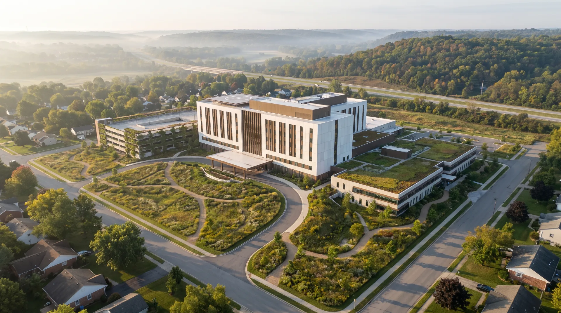
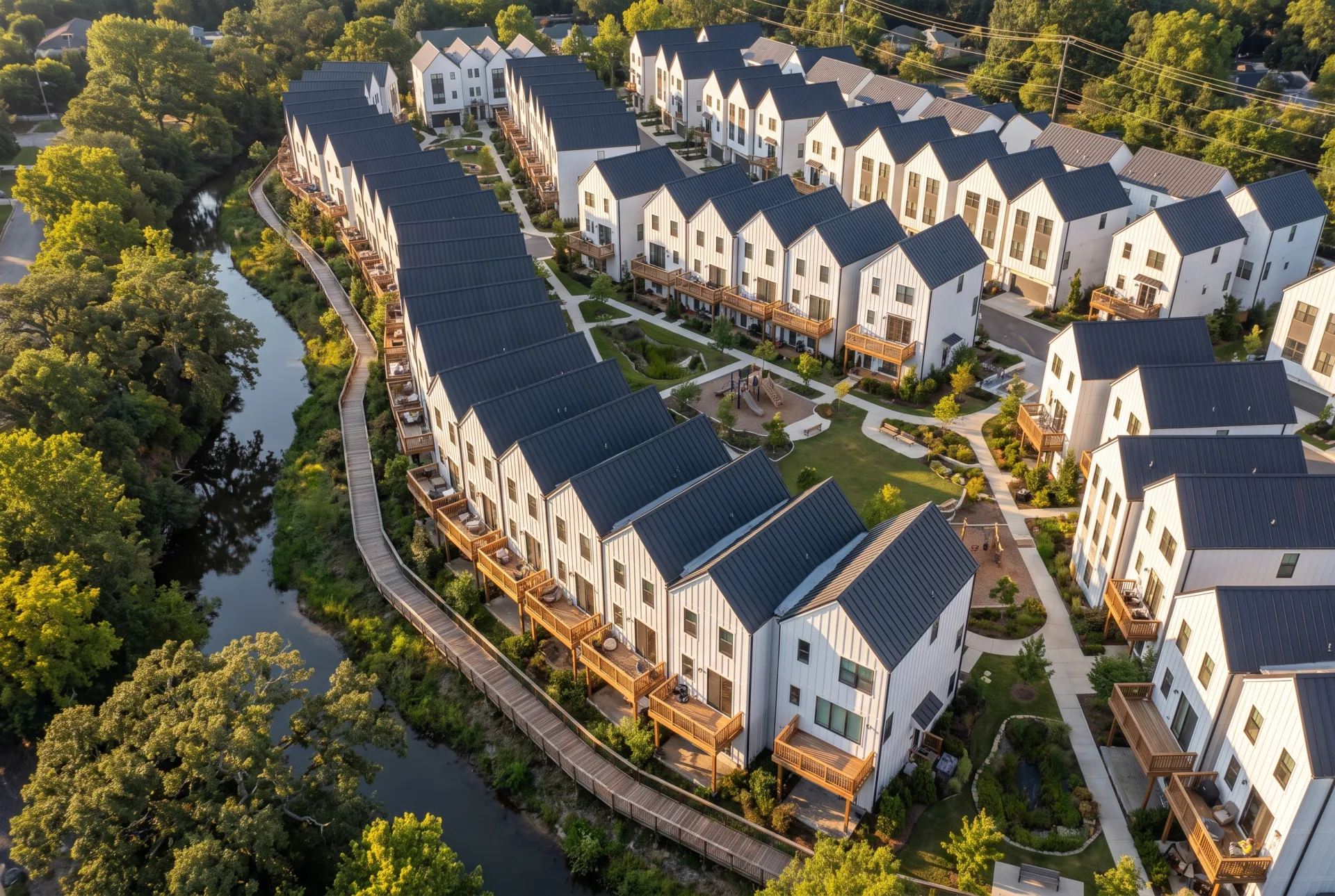
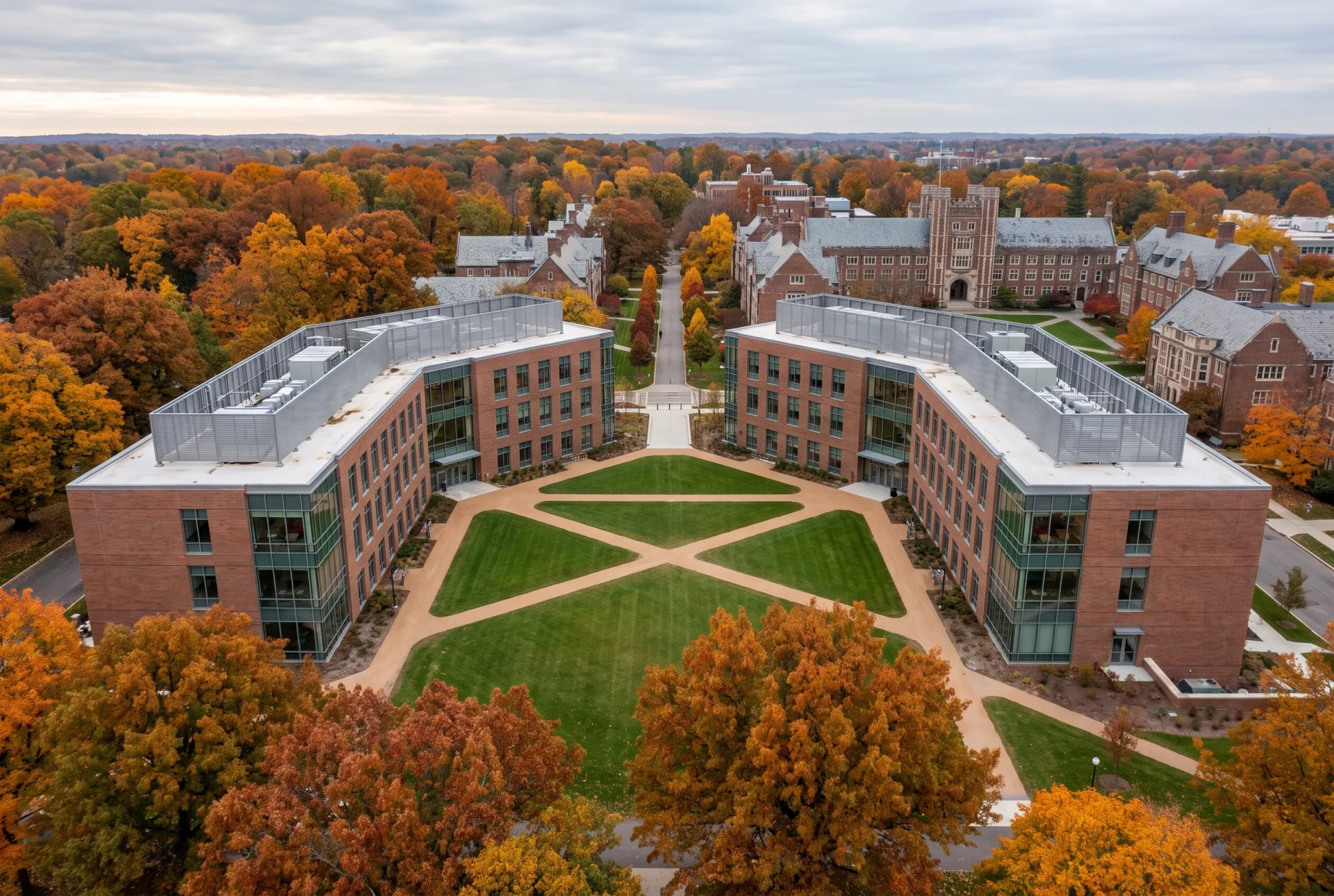
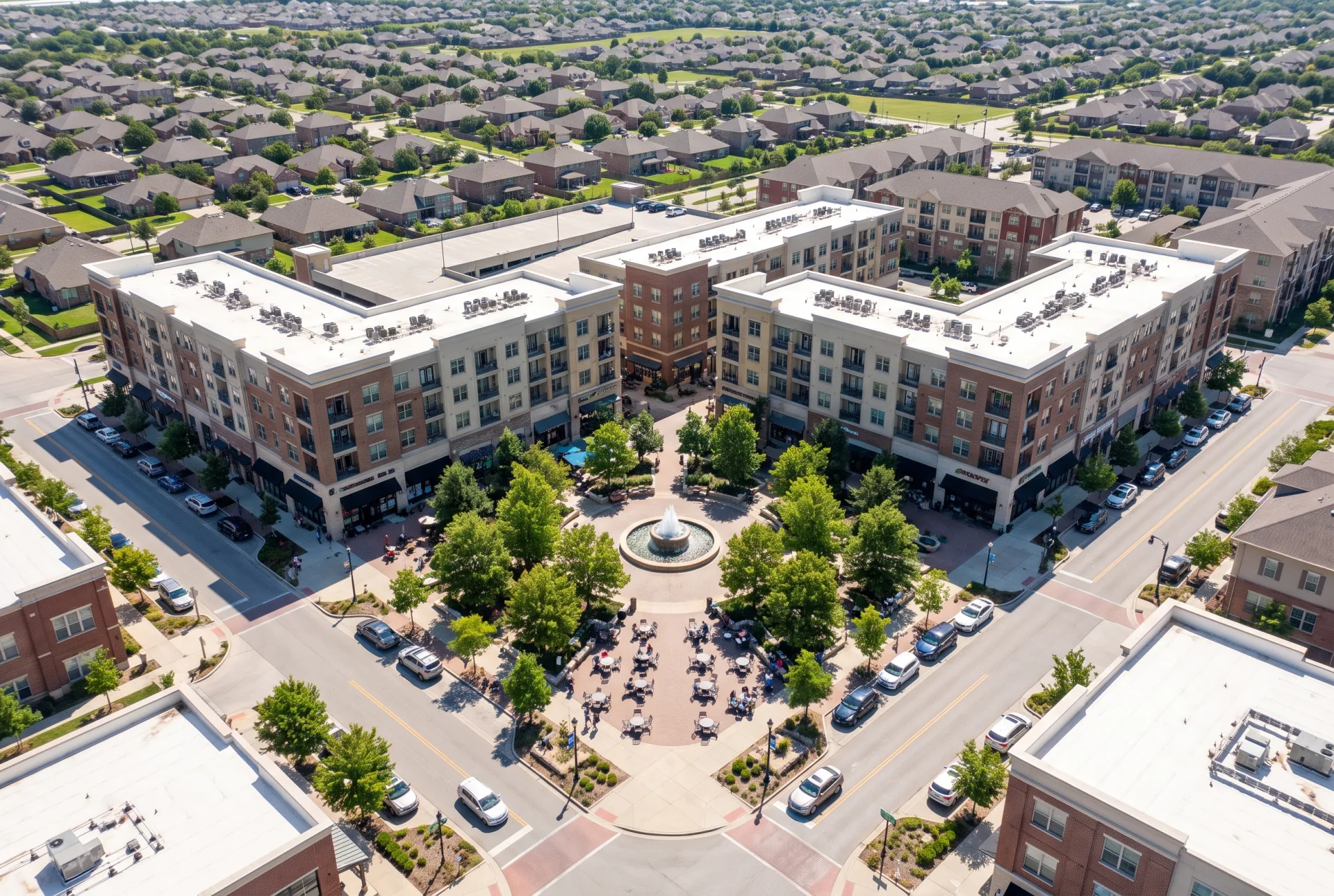
Aerial renderings from our studio
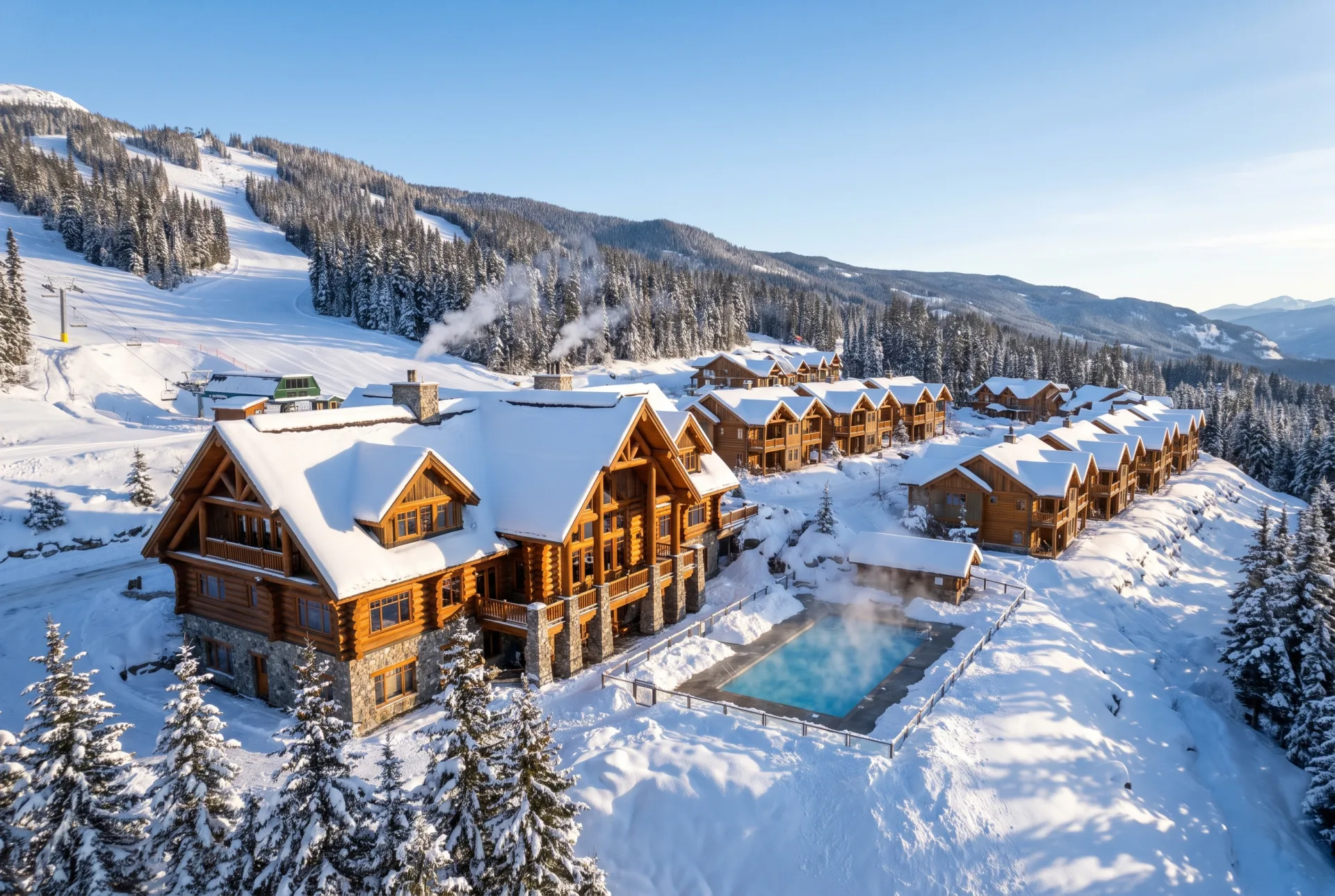
The four aerial renderings below show a townhouse community, a university science quad, a suburban town center and a mountain lodge resort, each captioned with the project type, site and the view delivered. They are concept work showing the range of sites we render from the air.
Why teams send us their drawings
Drawn by architects
Plans, sections and finish schedules are read the way they were drawn, so the first draft is close.
Priced before we start
A fixed quote within 12 hours of receiving your files. The quote you accept is the one you pay.
A clay draft first
Camera angles and massing are agreed on a plain model before materials go on, so the final has no surprises.
Yours to use anywhere
Full commercial rights and 4K JPG and PNG files for print, web and listings.
03
Who orders aerial rendering?
Developers use aerials in investor decks and site boards, architects in planning submissions, and municipalities in masterplan consultations. An aerial is one type of view in our architectural visualization services, and it is often the first image ordered on a large scheme, because it answers the question every investor and planning board asks first: what goes where on this site. Developers selling homes off plan pair the aerial with eye-level and interior views in a pre-sale set; our real estate 3D rendering page shows how those sets are put together. Builders of subdivisions use one aerial per phase to show buyers which lots are released.
04
Aerial perspective and context
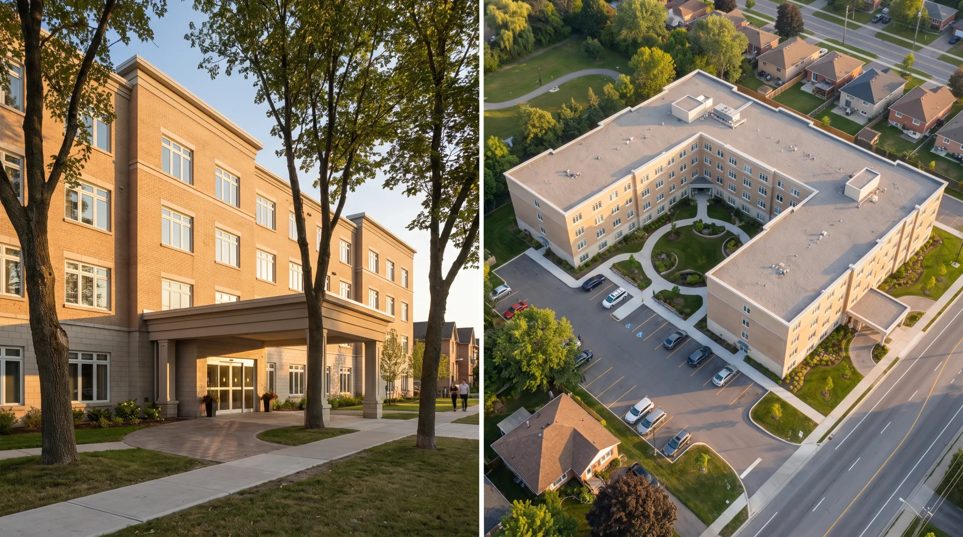
Aerial views show how a project sits among its roads, neighbors and landscape, which eye-level views cannot. At street height, the building fills the frame and the site disappears behind it. From above, a planning board sees the setbacks, the parking, the height against the next block and the green space in one picture.
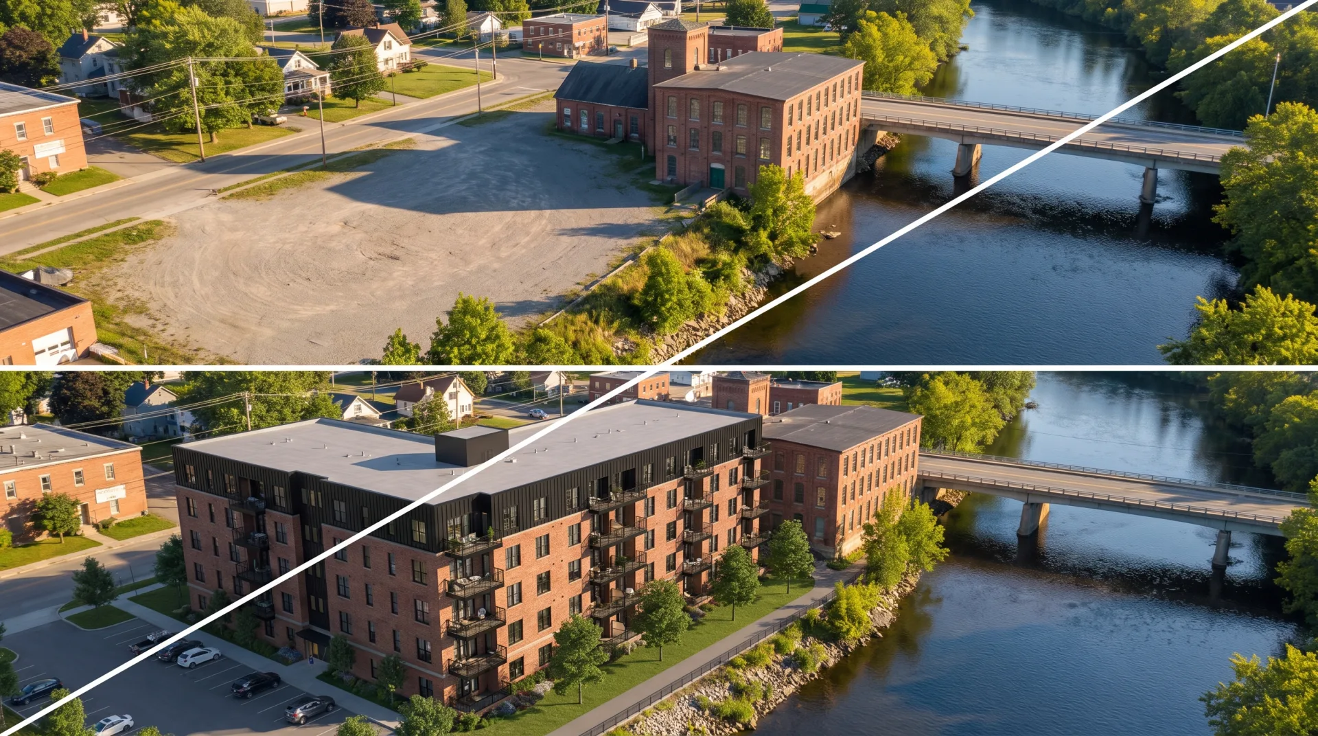
The image above shows one project from both heights. A high camera reads almost like a plan, which is why reviewers trust it for layout; our page on camera angles explains how height and angle change what a viewer understands. From above, planting carries much of the picture, so trees, lawns and paving are modeled to the landscape plan; if the landscape is the subject, landscape architecture rendering covers gardens and public space in more detail.
In painting, aerial perspective means the fading of color with distance. On this page the word aerial means a high camera, although a rendered aerial does use that haze to give depth to the far horizon.
What clients said about our interior designer's work
I sent over our floor plans and a few reference photos, and they took it from there. What stood out was how little back-and-forth we needed. They understood the brief and got most things right on the first attempt. The final images were exactly what our marketing team needed.
Robert Hayes · United States
We were struggling to agree on finishes for a client's kitchen renovation. Having the different options rendered made the decision so much easier. It saved us from making what could have been a very expensive mistake. Money well spent.
Emily Carter · United Kingdom
Honestly, the first draft wasn't quite what I had pictured. I sent through my comments, and the revised version was spot on. I appreciated that they actually listened rather than rushing through the changes. Happy with how everything turned out.
Daniel Cooper · Australia
05
How does an aerial rendering help your project win approval and funding?
An aerial rendering shows investors, planning boards and buyers the whole site in one image, so meetings go on the design itself rather than on reading site plans. The view from above answers in seconds what a drawing set takes an hour to explain: where each building sits, how traffic reaches it and what stays green.
- Planning boards and review panels see setbacks, parking, heights against the next block and open space in their real context, so the approval discussion stays on the design.
- Investors and lenders see what goes where on the site before money is committed, which makes an aerial the natural cover image of an investor deck.
- Developers market and pre-sell phases off-plan, with one aerial per phase showing buyers which lots or buildings are released.
- Massing and layout are judged from above while a change is still a drawing edit, not a change on site.
- We read site plans, levels and landscape plans as you drew them, so the first draft needs fewer corrections.
- Every aerial comes with full commercial rights as a 4K file, ready for site boards, hoardings, decks and planning portals.
Each service's 3D rendering price is on our pricing page.
06
How long does aerial rendering take?
A first aerial view arrives in 3 to 5 business days from complete files, and the date of the final is fixed in the quote.
| Stage | Time |
|---|---|
| Fixed quote | Within 12 hours of receiving files |
| First draft | 3 to 5 business days |
07
What do you need to send us?
Send the site plan, the building drawings or model, and drone photos if you have them.
- 01Send the site plan and the building drawings or model, as DWG, PDF, Revit, SketchUp, Rhino or IFC.
- 02Add drone photos of the site, or the street address so we can study the surroundings.
- 03Include the landscape plan, with tree species and paving where they are specified.
- 04Mark the camera angle you want on the site plan, or describe it, for example from the southeast over the park.
08
How do revisions work?
Revisions confirm the camera and context on a clay draft first, then materials, landscape and light on the colored draft, with two rounds included. A high camera is quick to move on a clay model and slow to move once every tree and car is placed, so we ask for the angle to be settled first.
- 01Approve the camera height, angle and framing on the clay draft.
- 02Check the context: neighboring buildings, roads and terrain.
- 03Check materials, landscape, cars and people on the colored draft.
- 04Approve the light, season and sky for final delivery.
09
What file formats do you deliver?
Aerials arrive as JPG and PNG in 4K, with a layered PSD on request. If an aerial will be printed on a large site board or hoarding, put the print size in the brief so the quote covers it.
| Format | Use | Default size |
|---|---|---|
| JPG | Planning portals, decks, websites | 4K |
| PNG | Presentation boards and brochures | 4K |
| Layered PSD | Your own edits and labels in Photoshop | 4K, on request |
You get full commercial use of every image, with no time or place limit.
Questions
Can you use our drone photos?
Yes. Send the drone photos with the date and time they were taken, and we match the camera, lens and sun so the model sits in the real photograph.
Do you need a site survey?
A survey helps on sloping sites, but it is not required. A site plan with levels, plus photos or an address, is enough for most aerials.
Can the same model give eye-level views?
Yes. Once the site is modeled, eye-level exterior views of the same project come from the same model, so the aerial and the street views match in every material, tree and car.
Get a quote for aerial rendering
Send the brief and files through the form and we reply with a fixed quote within 12 hours. We are a 3D rendering firm working remotely for clients in the US and worldwide, and the people modeling your site have designed buildings themselves.